Aquascope Logo
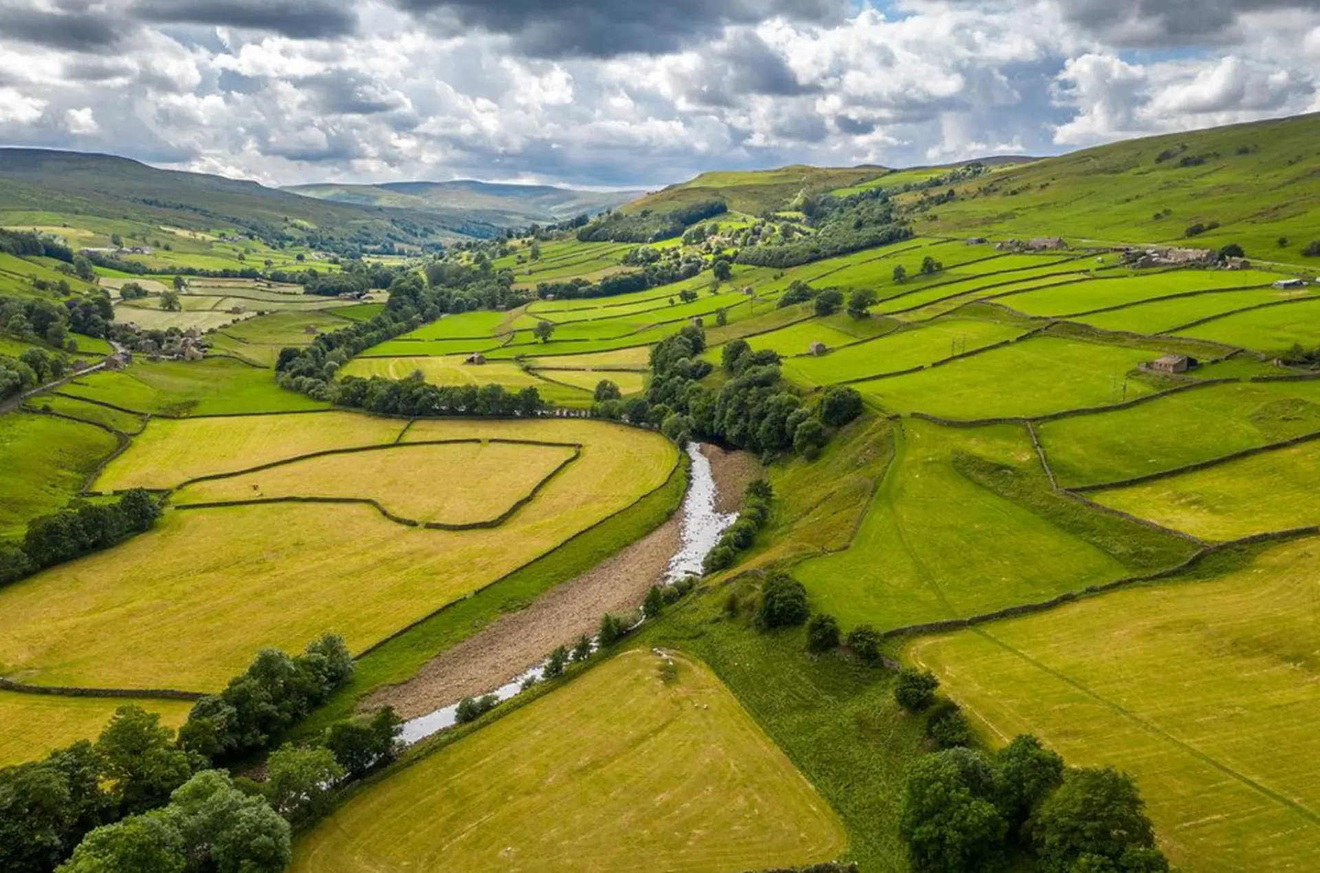
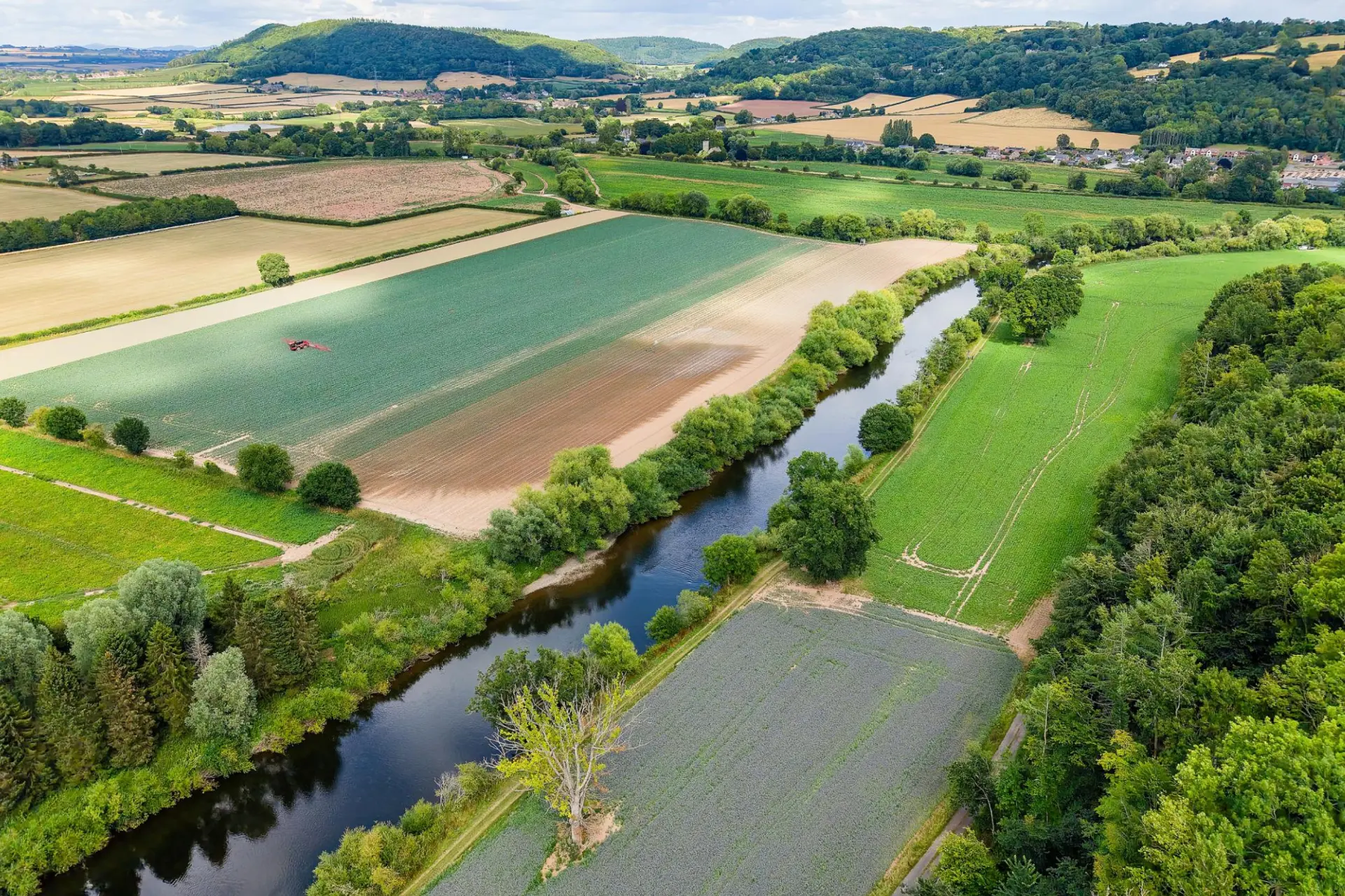
    River winding through green agricultural fields and a rural valley

    Case Study / Regenerative Agriculture & Water Quality

    Scaling Water Quality Intelligence Across Five UK River Catchments

    Helping WWF-UK understand how land management, agricultural practices and restoration interventions can improve river health — using Aquascope’s integrated environmental intelligence platform.

    Client

    WWF-UK

    Location

    England and Wales, United Kingdom

    Project period

    2024–2025

    Sector

    NGO & Food and Beverage

    Landscape regenerative practices / WWF-UK

    Understand the baseline.
    Plan better interventions.
    Monitor the outcomes.

    Across five contrasting river catchments in England and Wales, Aquascope developed an integrated approach to understanding water quality, river flows and the potential benefits of landscape interventions.

    By connecting catchment-scale modelling with accessible environmental data and scenario analysis, the project provides an evidence base for more informed decisions on regenerative agriculture, pollution reduction and sustainable catchment management.

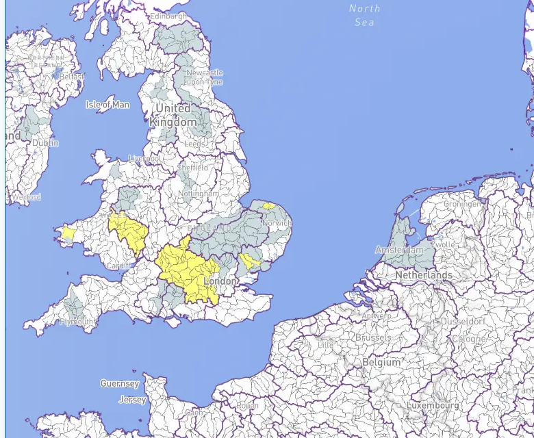
    Actual Aquascope map with UK catchments highlighted
    Five catchments. A connected platform for water intelligence.

    01 / The challenge

    How do you demonstrate the water benefits of landscape transformation?

    Agriculture, land use and wastewater discharges all influence the quality of water flowing through our landscapes. Organisations investing in regenerative agriculture and catchment restoration need to understand how these activities affect river ecosystems and downstream communities.

    Catchments contain multiple pollution sources, monitoring is often fragmented, and changes in water quality can take years to emerge. The challenge is to understand the cumulative impact of interventions across an entire river system.

    To invest effectively in landscape transformation, organisations need to understand where pressures originate and how different interventions could change outcomes.

    River bordered by agricultural fields, trees and rural landscapes
    Land management and river health are connected across the wider landscape.

    02 / The Aquascope solution

    One integrated platform. From environmental baseline to measurable outcomes.

    Aquascope combines process-based hydrological and water-quality models with environmental observations, geospatial information and monitoring data to build a connected picture of catchment conditions.

    Aquascope developed an integrated modelling system combining environmental baselines, scenario analysis and ongoing monitoring. The platform provides robust, evidence-based practical tools for assessing landscape transformation and comparing voluntary and incentive-based approaches.

    01 / BASELINE

    Understand the landscape

    Establish a consistent environmental baseline describing river flows, nutrient concentrations, land use and the factors influencing water quality. A reference against which environmental changes and future interventions can be assessed.

    Understand existing conditions, identify pressures and establish a defensible basis for decision-making.
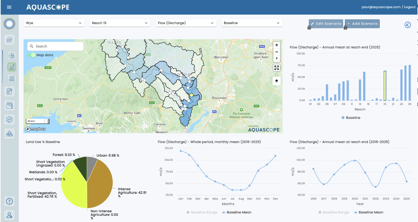
    Aquascope baseline dashboard showing flow and land-use data across the Wye catchment
    BASELINE — river flows, land use and water-quality conditions
    02 / SCENARIO

    Plan interventions

    Evaluate how agricultural practices, nutrient management, land use and wastewater treatment could affect water quality. Compare alternative intervention strategies before committing resources.

    Support investment prioritisation and identify strategies with the greatest potential environmental benefit.

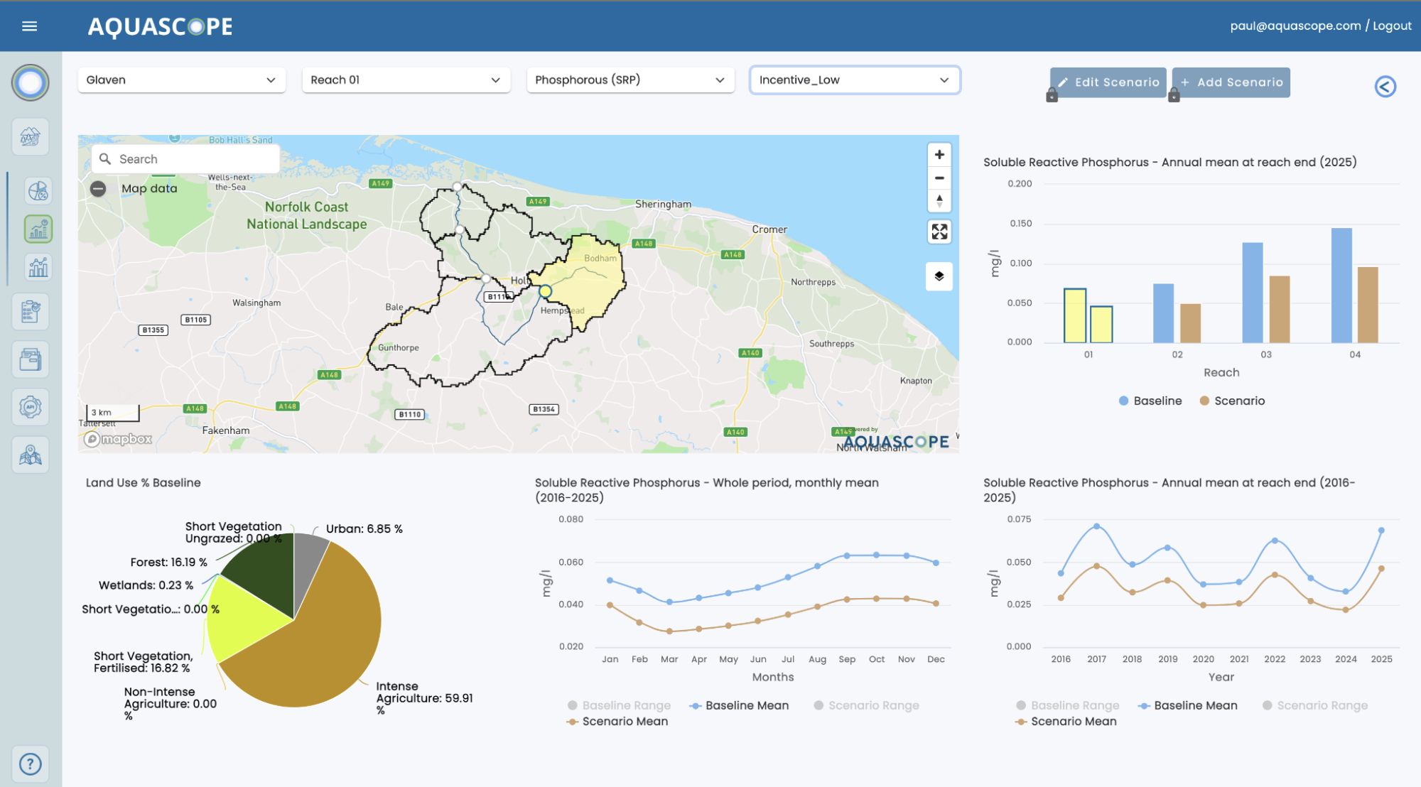
    Aquascope scenario dashboard comparing phosphorus outcomes across the Glaven catchment
    SCENARIO — comparing potential intervention outcomes, not measured improvements
    03 / MONITOR

    Track progress

    Connect modelled baselines with ongoing environmental observations to understand changing river conditions and assess progress over time.

    Support environmental performance tracking, adaptive management and evidence-based reporting.

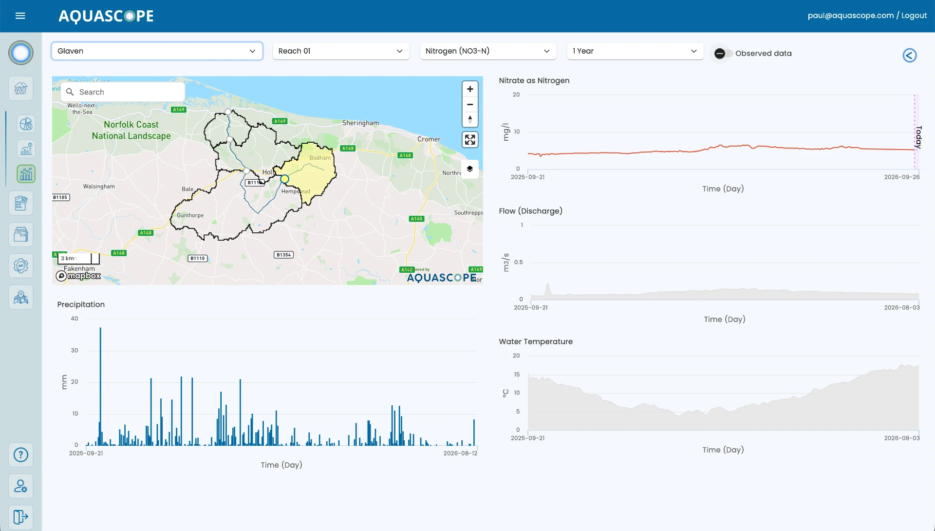
    Aquascope monitoring dashboard showing nitrate, flow, temperature and precipitation data
    Daily water quality monitoring against baselines

    Explore the catchment intelligence in action

    A walkthrough of the Aquascope platform: catchment map and reach selection, baseline charts and AI-supported interpretation

    03 / Five catchments. One scalable approach.

    Designed for diverse landscapes. Built to scale.

    Five catchments with contrasting agriculture, landscapes, hydrology and pollution pressures. One consistent approach, accounting for local characteristics.

    River Wye

    A major agricultural catchment facing nutrient pressures from livestock farming, land management and wastewater sources.

    East Cleddau

    An agricultural catchment where land management and nutrient transport influence downstream water quality.

    West Cleddau

    A contrasting river system with agricultural and wastewater-related water-quality pressures.

    River Stiffkey

    A Norfolk chalk-influenced catchment where agricultural nutrient losses and groundwater processes influence river conditions.

    River Glaven

    A smaller Norfolk catchment connecting agricultural pressures, groundwater and river ecosystem conditions.

    04 / Turning interventions into investment decisions

    Understand the potential impact before investing.

    Restoring catchment health requires decisions about where to intervene, which measures to adopt and how to allocate limited resources. Scenario modelling helps explore the potential effects before implementation.

    Regenerative agriculture

    Assess the potential effects of improved soil management, cover crops, buffer strips and changes in agricultural practices.

    Nutrient management

    Explore how fertiliser application, livestock management and nutrient losses could influence river conditions.

    Wastewater improvements

    Understand the potential contribution of wastewater treatment upgrades alongside agricultural measures.

    Catchment restoration

    Assess how land management and restoration strategies could contribute to improved water quality.

    Compare interventions across a catchment to support more targeted, evidence-based investment decisions.

    05 / Landscape-scale intelligence

    Connecting farm-level action with catchment-level outcomes.

    Interventions happen at individual farms and sites, while their impacts are experienced across connected river systems. Aquascope models how water, nutrients and environmental pressures move through the catchment.

    01

    Local interventions

    Agricultural management, restoration and pollution reduction.

    02

    Catchment processes

    Water movement, nutrient transport and river-system response.

    03

    Landscape outcomes

    Potential changes in nutrient concentrations, river conditions and environmental pressures.

    From individual interventions to the cumulative environmental performance of an entire landscape.

    06 / Value delivered

    Environmental intelligence that supports action.

    The WWF-UK project established a practical foundation for assessing water-quality pressures and evaluating intervention strategies across multiple catchments.

    Consistent environmental baselines

    A comparable understanding of water-quality and hydrological conditions across five contrasting catchments.

    A trusted environmental baseline supporting policy on voluntary and incentive financing schemes

    Evidence for intervention planning

    Scenario-based insights into the potential contribution of agricultural and wastewater management measures.

    Practical evidence to inform engagement with farmers, retailers, water companies and policy makers

    Scalable catchment assessment

    An approach that can be adapted to additional river systems while accounting for local characteristics.

    A foundation for long-term ecosystem monitoring across the five catchments

    Foundation for ongoing monitoring

    A basis for tracking environmental change and supporting longer-term assessment of restoration outcomes.

    Now scaling strategic water quality monitoring with targeted measurements to verify daily nutrient pollution, trends and farm intervention outcomes

    07 / Commercial applications

    Built for organisations managing water across landscapes.

    Food & Beverage Supply Chains

    Understand water-related pressures across agricultural sourcing regions and assess the potential benefits of regenerative farming programmes.

    Water Utilities

    Explore diffuse and point-source pollution pressures, compare catchment measures and support investment planning.

    Natural Capital & Land Asset Managers

    Establish environmental baselines, evaluate restoration opportunities and monitor water-related ecosystem services.

    Catchment Partnerships & Environmental Organisations

    Develop evidence-based restoration strategies and coordinate action across multiple stakeholders.

    Aquascope helps connect environmental investment with the water outcomes that matter.

    08 / Technology and scientific credibility

    Grounded in science. Delivered through technology.

    Established hydrological and water-quality modelling, geospatial datasets, environmental observations and operational digital tools make sophisticated analysis accessible for real-world decisions.

    Environmental inputs

    • Satellite and geospatial datasets
    • Environmental observations
    • Land use and monitoring data

    Integrated modelling

    • Catchment hydrology and river flow
    • Nutrient and water-quality transport
    • Land-management scenarios

    Aquascope intelligence

    • BASELINE assessment
    • SCENARIO comparison
    • MONITOR and forecasting capabilities
    • Interactive decision-support tools

    09 / Project partners

    Collaboration across environmental science and implementation.

    World Wide Fund for Nature logo

    World Wide Fund for Nature (WWF-UK)

    Project commissioning organisation and strategic environmental partner.

    Aquascope

    Integrated environmental intelligence platform, catchment assessment and decision-support technology.

    Water Resource Associates

    Hydrological and water-quality modelling expertise.

    The WWF-UK project context

    WWF commissioned Water Resources Associates and Aquascope to develop an integrated, catchment-scale modelling system to understand the interventions required to achieve sustainable water quality in key UK river systems. This work supports WWF-UK’s ambition for 50% of UK fresh food to originate from catchments managed sustainably, enabling constructive engagement with farmers, retailers, water companies and policy makers.

    Project objectives

    • Establish a consistent environmental baseline across five distinct river catchments
    • Assess freshwater flow, discharge volumes and nutrient outcomes under different interventions
    • Understand how rising stream temperatures could alter algal growth and future mitigation needs

    10 / Future potential

    Scaling environmental intelligence across agricultural landscapes.

    The project demonstrates how catchment-scale intelligence can support a more systematic approach to regenerative agriculture and water-quality improvement.

    By combining baselines, scenario analysis and ongoing monitoring, organisations can better understand water-related pressures, plan interventions and assess progress across multiple landscapes. This creates opportunities to extend consistent intelligence across agricultural supply chains, restoration portfolios and water-management programmes.

    Conclusions and next steps

    The modelling provides evidence to support regenerative landscape practices and sustainable water quality. As climate change raises stream temperatures and alters algal growth responses, continued monitoring will help identify where new mitigation measures are required.

    Environmental intelligence / Informed investment

    Invest in nature with a clearer understanding of water.

    Whether managing agricultural supply chains, restoring catchments or investing in natural assets, Aquascope provides the environmental intelligence needed to assess risks, plan interventions and monitor outcomes.

    Be the first to know what’s next in freshwater intelligence

    Subscribe for early access to new features, expert insights, and exclusive updates on water monitoring and restoration.

    Keep in touch