
Fragmented information
Water-quality, hydrological and environmental datasets need to be brought together into a coherent operational view.
Case Study / Water Utilities / Commercial Pilot
Supporting water utilities with integrated catchment modelling, water-quality forecasting and more informed operational planning.
Blackwater / Utility operational intelligence
Water utilities depend on understanding the conditions of the rivers and catchments supplying their infrastructure. Changes in rainfall, river flow, land management and pollution pressures can influence raw-water quality, creating operational challenges for abstraction, treatment and long-term catchment management.
Through a commercial pilot in the Blackwater catchment in Essex, Aquascope demonstrated an integrated approach to bringing environmental observations, catchment modelling and digital water-quality intelligence together in one platform.
01 / The challenge
Rainfall, river flow, agricultural land use, wastewater inputs and seasonal changes can all affect the conditions reaching abstraction and treatment infrastructure.
Relevant information is often distributed across monitoring systems, environmental datasets and different organisations. Bringing this information together into a consistent, catchment-wide understanding can help utilities move from reactive monitoring towards more informed planning.
Water-quality, hydrological and environmental datasets need to be brought together into a coherent operational view.
Water-quality pressures vary across space and time, requiring an understanding of upstream processes and downstream implications.
Utilities need timely, interpretable information to support decisions about abstraction, treatment and catchment interventions.
02 / The Aquascope approach
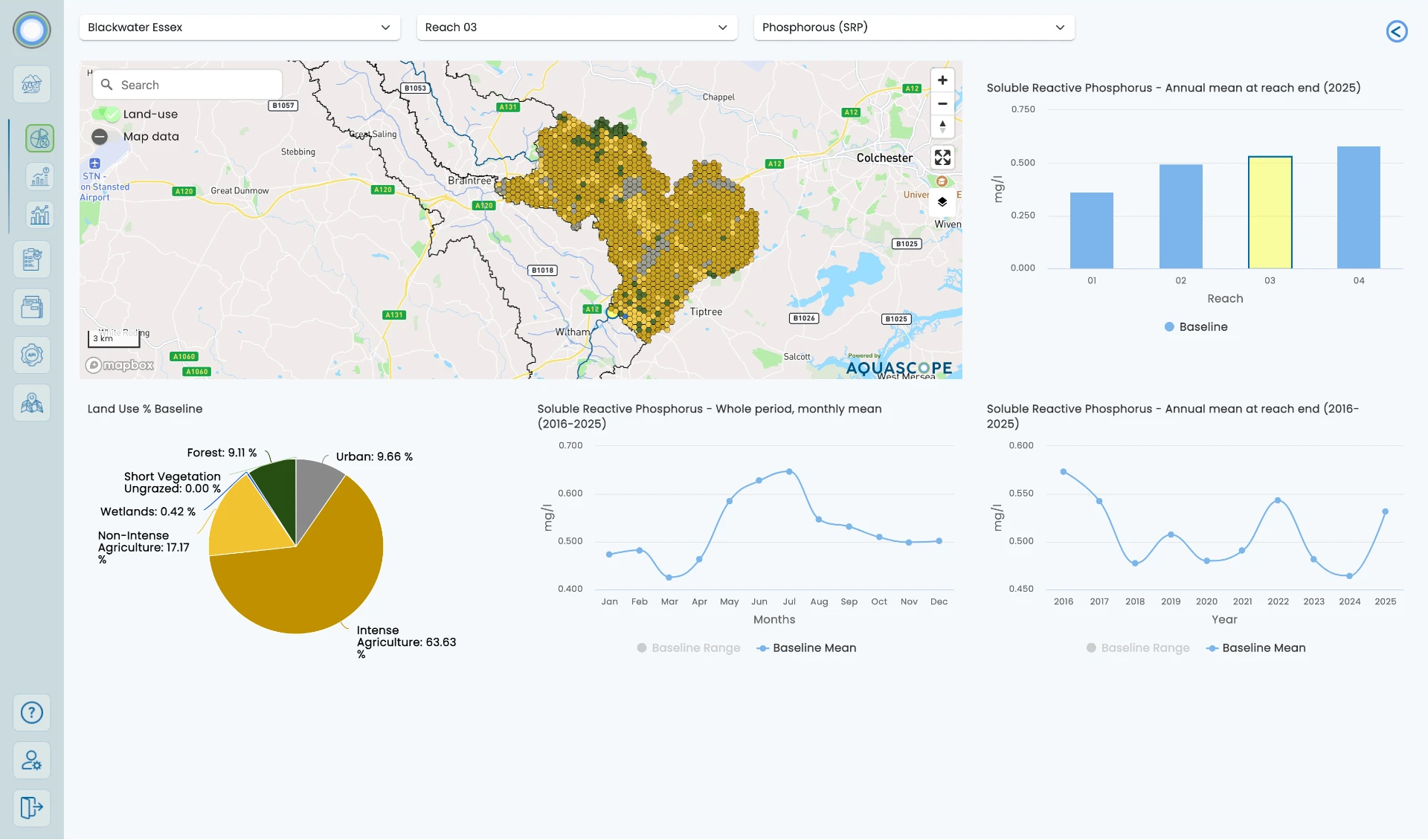
The Blackwater pilot explored how multiple environmental data sources could be integrated into a digital platform supporting baseline assessment, water-quality forecasting and access to structured information.
Bring together relevant environmental observations, land-use information, river flow and water-quality data within a consistent catchment framework.
Use process-based models to understand how rainfall, flow and catchment pressures influence water-quality conditions.
Combine modelled catchment processes with weather forecast information to provide forward-looking indicators of potential water-quality changes.
Make environmental intelligence accessible through dashboards and structured data services that can support wider operational systems.
Environmental data, weather information and catchment characteristics
Hydrological and water-quality modelling
Connected platform, dashboards and structured data services
Interpretable evidence for utility planning
03 / From baseline to forecast
BASELINE
Establish historical context for river flow, water quality and catchment pressures. Explore how environmental conditions vary across the catchment and how different factors may influence downstream water quality.
Support risk assessment, monitoring design and the identification of potential catchment pressures.
MONITOR
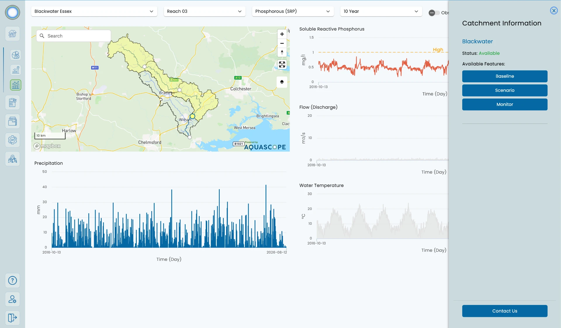
Bring together available environmental observations and modelled indicators to provide a consistent view of catchment conditions.
Help operational teams interpret changing conditions and prioritise further investigation where appropriate.
FORECAST
Use weather-driven hydrological and water-quality models to generate forward-looking information about river conditions.
Support advance planning for abstraction and treatment operations.
Workflow
04 / The operational use case
Understanding these relationships can help utilities interpret potential water-quality pressures and make better-informed operational decisions. Aquascope’s integrated approach is designed to connect catchment-scale environmental information with the practical requirements of water utility management.
Provide additional information about anticipated raw-water conditions to support operational planning.
Help teams anticipate possible changes in water-quality indicators relevant to treatment processes.
Understand the environmental pressures that may influence water quality over time.
Explore how catchment-management measures could affect future water-quality conditions.
05 / Understanding pollution pressures
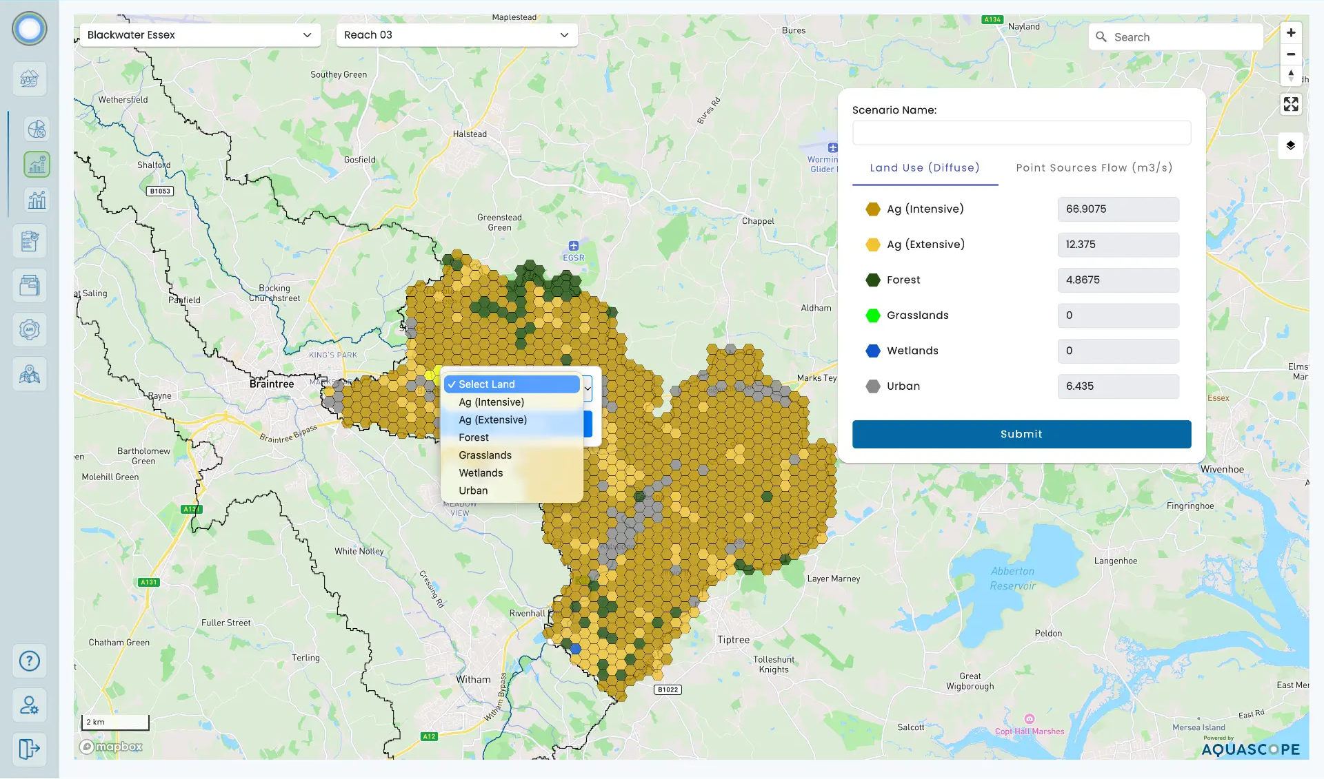
Catchment modelling can integrate information about land use, hydrology and potential pollution sources to support a more complete understanding of nutrient and sediment dynamics.
This creates a basis for exploring different catchment-management options and assessing how interventions could influence downstream conditions.
Catchment connections
06 / Value for water utilities
Connect environmental information with operational planning rather than relying on isolated datasets.
Use forward-looking water-quality information to support earlier consideration of potential changes.
Support assessment of catchment pressures and potential intervention options.
Provide a framework for extending environmental intelligence across additional catchments and utility assets.
07 / What the pilot demonstrated
The work established a technical foundation for exploring how historical catchment understanding, environmental monitoring and forecasting could be delivered through a connected digital environment.
A complex, branched two-river catchment represented within Aquascope’s modelling and platform framework.
Relevant monitoring and environmental information brought together to support catchment assessment.
Platform capabilities explored for historical analysis, forecasting and API-based structured data access.
Northumbrian Water is identified as the commercial pilot partner. This is not a client endorsement, a continuing production deployment or proof of a validated operational warning system.
08 / Scalable applications
A consistent digital approach to environmental intelligence can help organisations compare conditions across different catchments, support monitoring strategies and develop a clearer picture of risks across their water asset portfolios.
Aquascope’s approach combines environmental science, geospatial analysis and accessible digital services to support the wider adoption of catchment-scale decision intelligence.
Water Utilities / Operational Intelligence
Aquascope helps water utilities transform catchment data into practical environmental intelligence — connecting monitoring, modelling and forecasting to support more informed water-management decisions.
Stay connected with Aquascope’s latest developments, partnerships and water-intelligence insights.