
Water
Natural resilience
Understand seasonal flooding, wetland storage and landscape hydrology in regulating water and supporting downstream resilience.
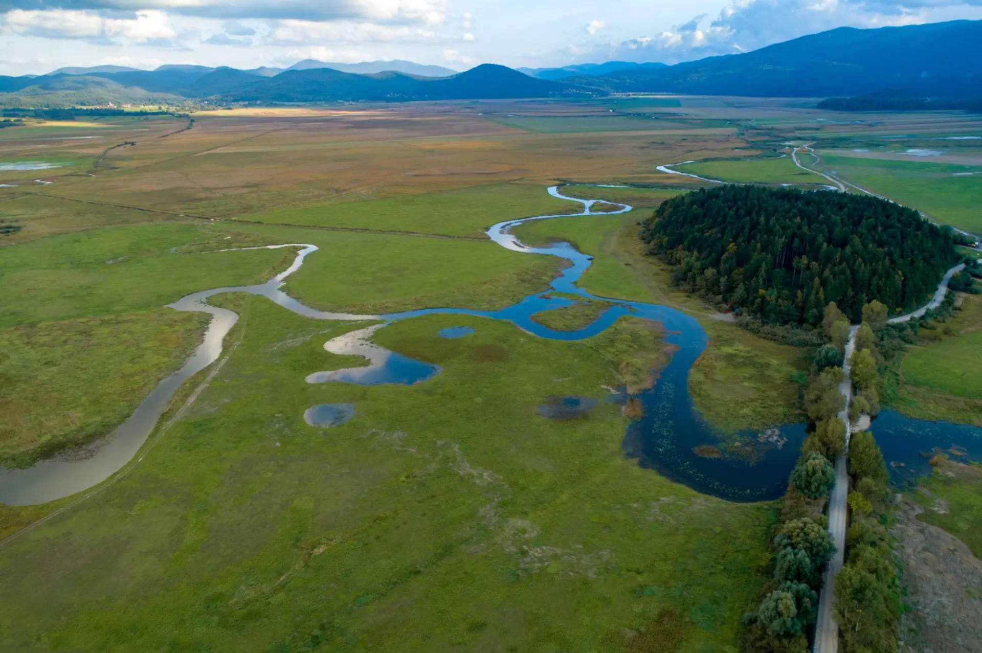
Case Study / Natural Capital / Wetlands / Digital MRV
Lake Cerknica, Slovenia
Connecting water, carbon and biodiversity intelligence in one of Europe’s most distinctive wetland landscapes.
Location
Notranjska Regional Park, Slovenia
Landscape
Intermittent lake, wetlands, grasslands and forests
Project focus
Conservation and ecosystem restoration
Environmental services
Water, carbon and biodiversity
Notranjska Regional Park / Environmental intelligence
Lake Cerknica, within Slovenia’s Notranjska Regional Park, is an extraordinary intermittent lake whose seasonal flooding sustains wetlands, forests, grasslands and internationally important biodiversity.
Working alongside the project partners, Aquascope provides integrated environmental intelligence to help assess ecosystem services, understand restoration opportunities and support the monitoring and reporting of natural capital outcomes.
Integrating water, carbon and biodiversity intelligence to support wetland conservation, restoration planning and credible environmental reporting.
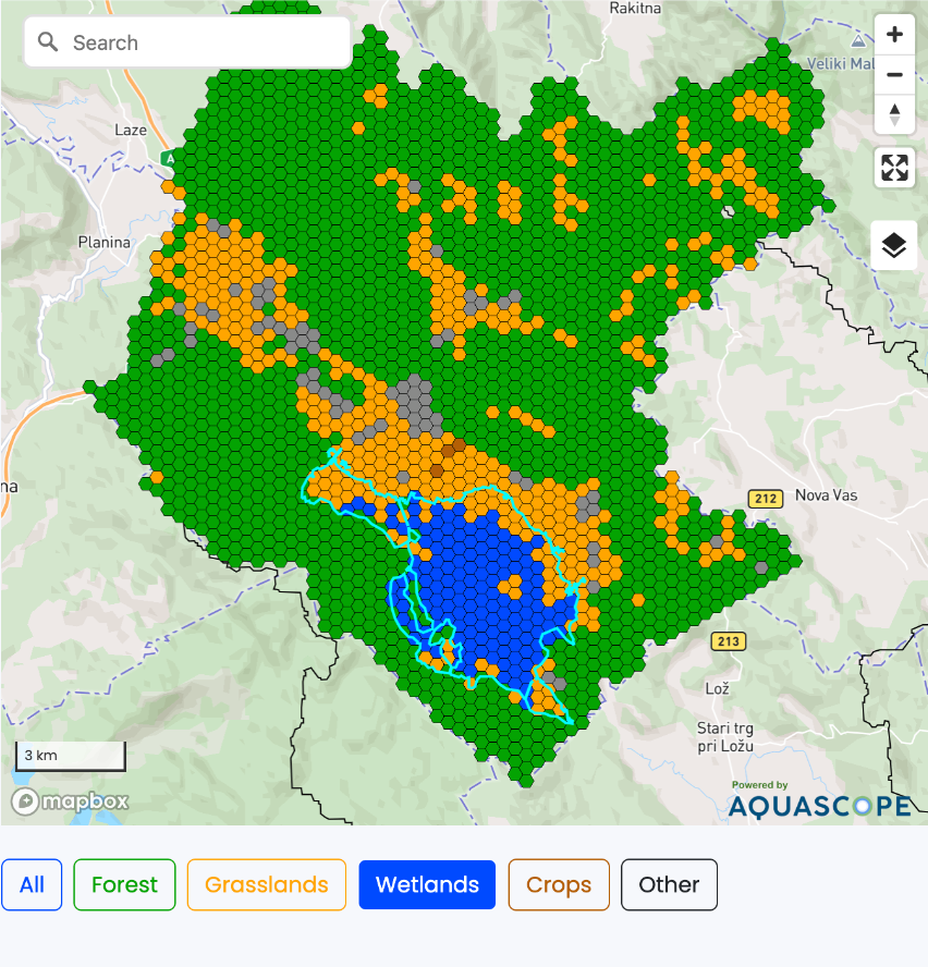
01 / The challenge
Healthy wetlands and forests provide interconnected benefits, from storing and regulating water to supporting carbon-rich ecosystems and biodiversity.
Yet many natural capital projects assess these benefits independently, making it difficult to understand their combined value or demonstrate how restoration and conservation activities influence the wider landscape.
For project developers and investors, the practical challenge is to assess environmental benefits consistently, monitor them over time and communicate them through credible, transparent evidence.
At Lake Cerknica, seasonal changes in water extent and wetland conditions make integrated environmental assessment particularly important.
Natural capital investment needs more than individual environmental indicators. It needs a connected understanding of how ecosystems function.
02 / The landscape
Natural resilience
Understand seasonal flooding, wetland storage and landscape hydrology in regulating water and supporting downstream resilience.
Climate benefits
Assess carbon stocks and the potential effects of wetland conservation, rewetting and improved forest management on long-term carbon outcomes.
Ecosystem health
Understand habitats and landscape conditions supporting biodiversity, and how conservation and restoration can contribute to ecosystem resilience.
03 / The Aquascope solution
Map land cover, ecosystem characteristics and environmental conditions to establish a consistent reference for project assessment. Connect water-related ecosystem services with carbon stocks and habitat conditions.
Establish the environmental evidence needed for project development, investment assessment and long-term monitoring.
Assess how land-management and restoration interventions could influence environmental conditions. Explore the potential effects of wetland restoration, rewetting, conservation and forest management.
Support project design, intervention prioritisation and more informed allocation of restoration resources.
Integrate environmental observations and modelled indicators to follow changes in landscape conditions over time. Build an evidence base for adaptive management, environmental reporting and future independent assessment.
Support transparent environmental performance reporting and ongoing project oversight.
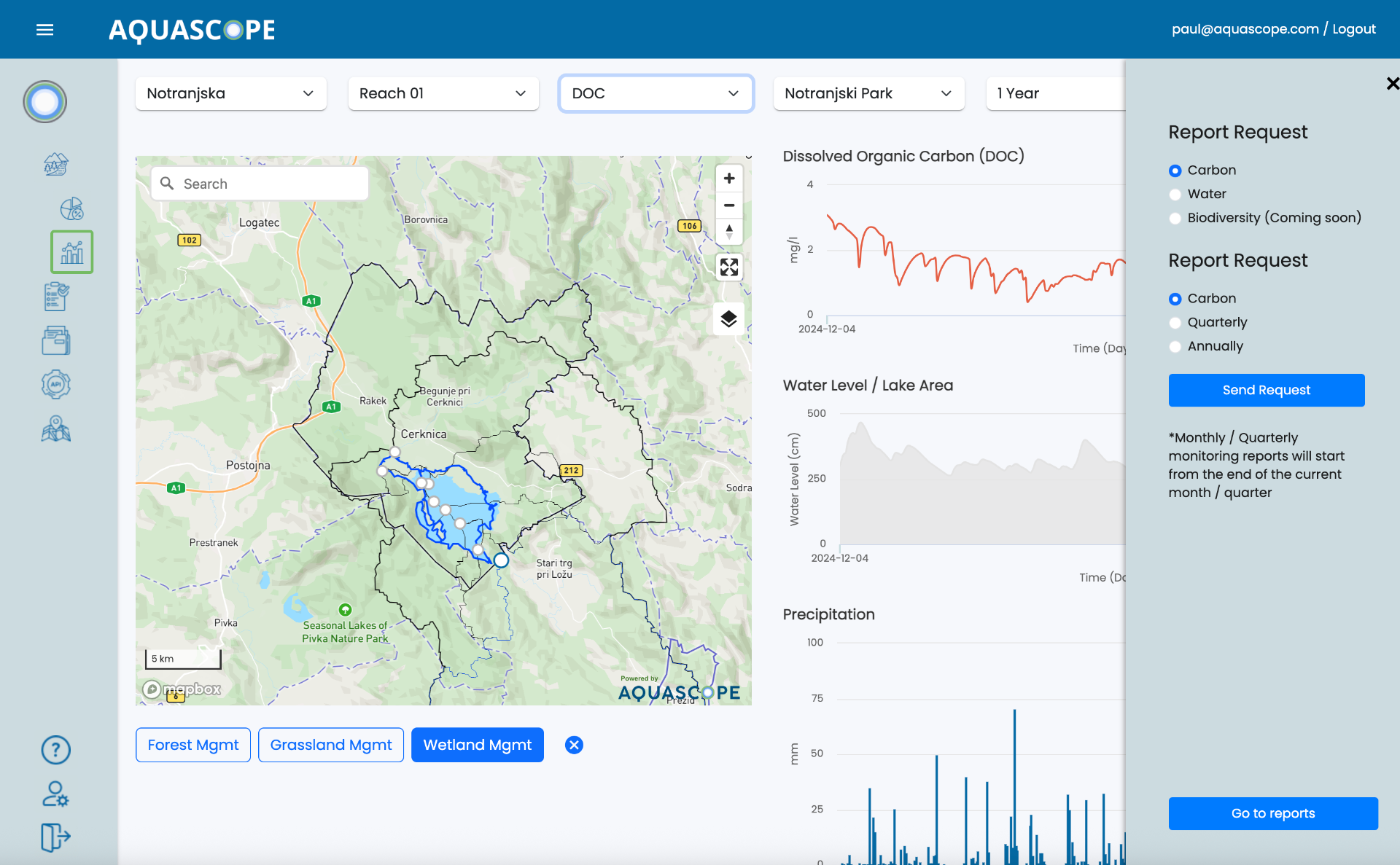
The existing project established baseline carbon, water and biodiversity calculations, inputs for project development documentation and a digital monitoring platform for longer-term wetland project assessment. Modelled indicators and measured observations remain distinct.
04 / Water connects the landscape
Seasonal water movement and landscape connections.
Water availability, wetland extent and soil processes.
Connections to carbon dynamics and habitat conditions.
Connected evidence for natural capital decisions.
By connecting environmental processes rather than treating them in isolation, Aquascope supports more informed natural capital decisions.
05 / From environmental assessment to digital MRV
01
Establish environmental baselines and integrate relevant satellite, spatial, modelled and field observations.
02
Present environmental indicators and changes through structured dashboards and reporting outputs.
03
Provide traceable environmental evidence for qualified third parties to assess against applicable methodologies and project requirements.
Aquascope supports measurement and reporting. Independent verification and certification remain the responsibility of appropriately qualified third parties. Environmental monitoring does not automatically produce tradeable credits.
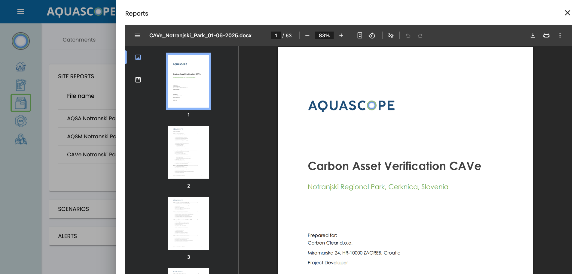
Reporting outputs connect environmental assessment with the information project teams need for oversight and independent review.
06 / Commercial value delivered
Bring water, carbon and biodiversity information together to support a more complete understanding of natural capital assets.
Use environmental baselines and scenario analysis to support project design and prioritise potential interventions.
Establish a consistent framework for tracking environmental indicators and understanding changes over time.
Extend consistent environmental assessment and monitoring approaches across additional landscapes and restoration projects.
07 / Investors and asset managers
Assess the environmental characteristics of prospective projects and understand their potential ecosystem-service benefits.
Establish baselines, compare intervention options and support the design of monitoring programmes.
Support the measurement and communication of nature-related activities across landscapes and supply chains.
Generate structured evidence that can contribute to reporting and disclosure, including TNFD-aligned nature assessments and other relevant frameworks.
08 / Project collaboration
Landscape stewardship, conservation priorities and local ecological expertise.

Natural capital project development and coordination.

Integrated environmental intelligence, modelling, geospatial assessment and digital monitoring infrastructure.
09 / Wider applications
The same approach can be applied across wetland restoration, peatland rewetting, forest conservation and other landscape-scale natural capital programmes.
By combining environmental baselines, scenario assessment and monitoring in one digital environment, organisations can develop a more consistent understanding of their assets and the outcomes they aim to deliver.
From individual restoration projects to entire natural capital portfolios, Aquascope helps make environmental performance more visible, understandable and actionable.
Environmental intelligence / Natural capital
Aquascope helps natural capital investors, project developers and land managers understand environmental conditions, evaluate restoration opportunities and monitor ecosystem services.
Subscribe for early access to new features, expert insights, and exclusive updates on water monitoring and restoration.