
Location-specific intelligence
Explore modelled water quality and flow across the river network, rather than relying exclusively on individual monitoring stations.
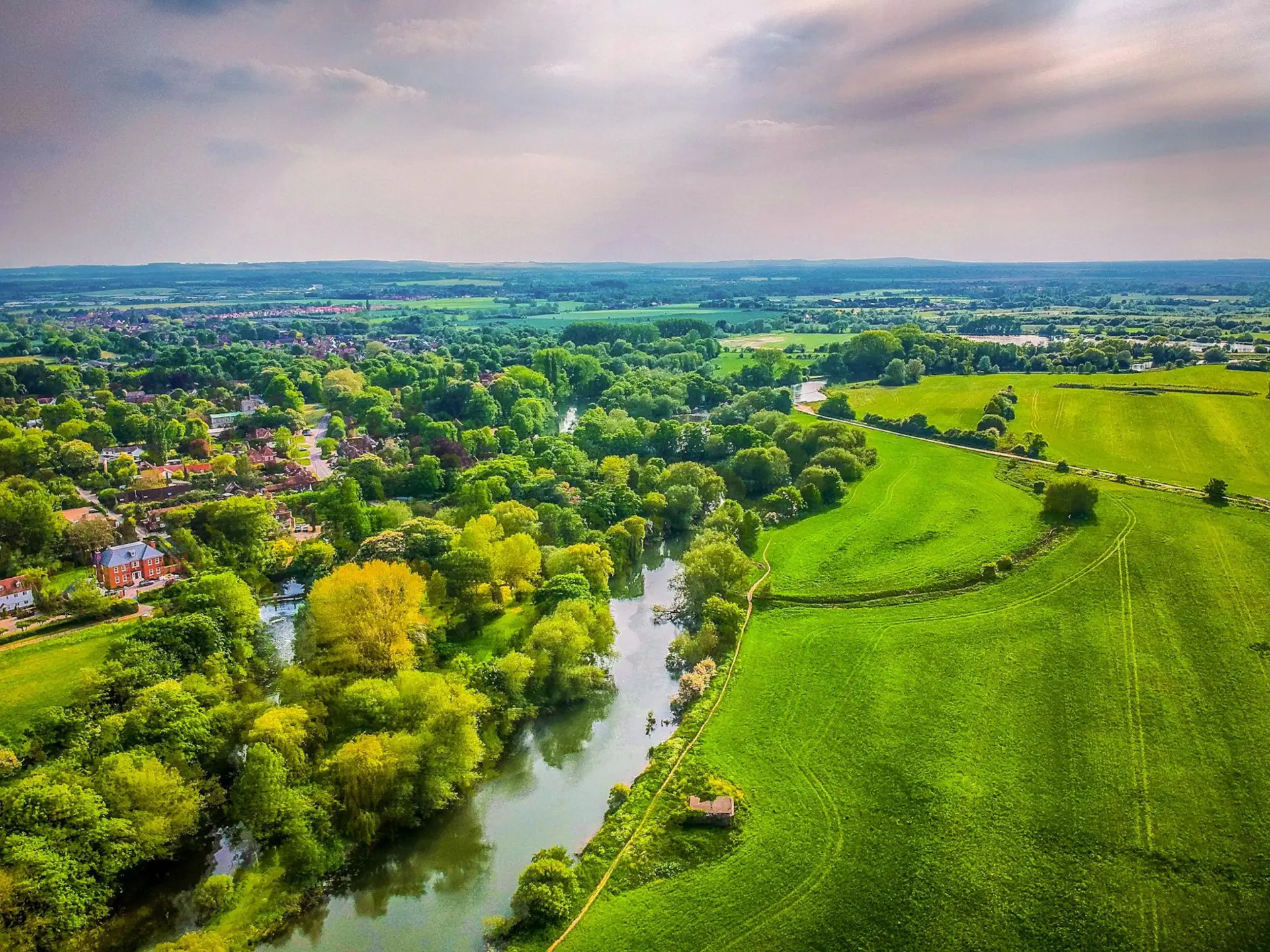
Project Case Study River Health Intelligence
From catchment-scale environmental science to accessible, location-specific water quality and flow forecasts — helping communities better understand their rivers.
LocationRiver Thames, United Kingdom
Geographic coverageCastle Eaton to Teddington Lock
Forecast horizonDaily insights · Five-day forecasts
Science, connected to everyday life
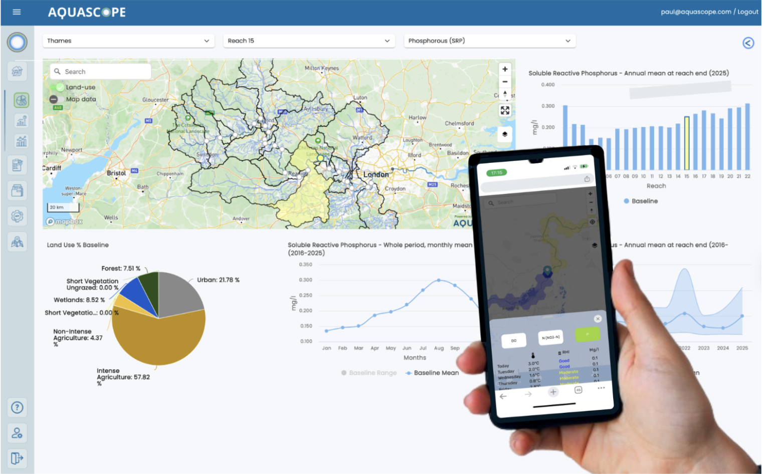
Aquascope and its scientific partners have developed an operational river health forecasting capability for the Thames, combining advanced hydrological and water-quality models with environmental observations to deliver daily insights and five-day forecasts directly to users’ phones.
Technology: Integrated hydrological modelling, water-quality forecasting, environmental observations and mobile delivery.

01 / The challenge
Rivers are dynamic systems. Water quality and flow conditions change with rainfall, land use, agricultural activity, wastewater inputs and seasonal ecological processes.
Yet communities often rely on infrequent sampling, historical measurements or fragmented information to understand conditions in their local river.
For recreational users, citizen scientists and local communities, this creates a significant information gap between what is happening in the river and what they can understand and act upon.
The challenge is not simply collecting more environmental data. It is making reliable, timely scientific intelligence accessible where and when people need it.
02 / The solution
Aquascope brings together process-based hydrological and water-quality modelling, satellite observations, in-situ monitoring and environmental datasets within a single forecasting platform.
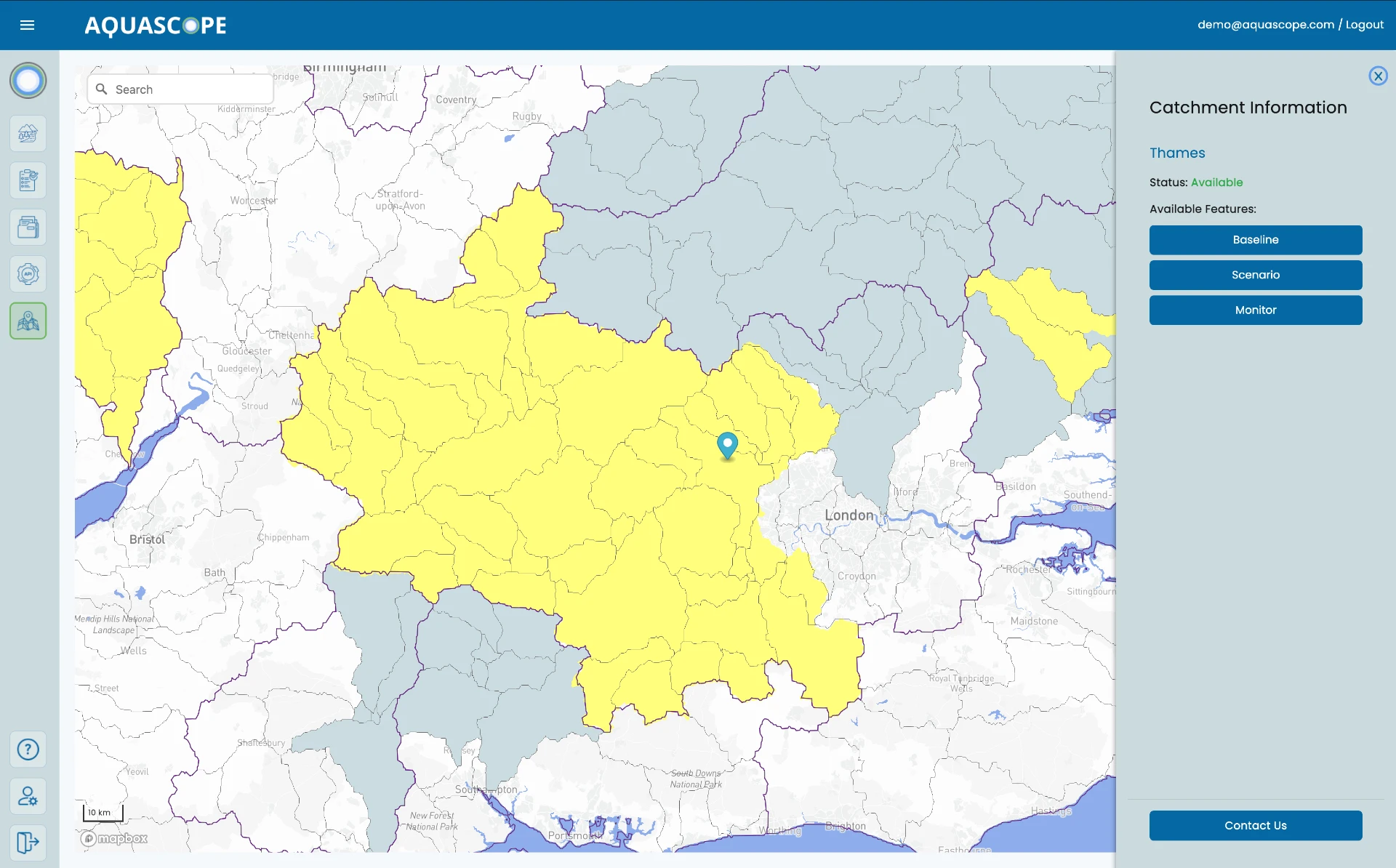
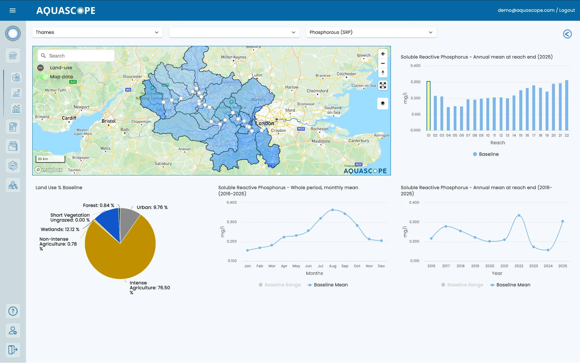
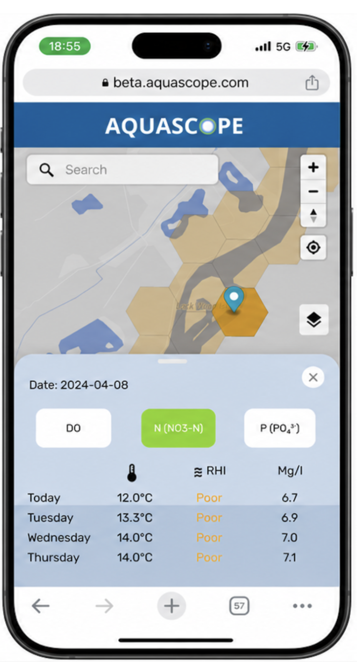
Spatially distributed intelligence across the Thames study area allows users to explore water quality and river flow at modelled locations through an accessible web and mobile interface.
Explore modelled water quality and flow across the river network, rather than relying exclusively on individual monitoring stations.
Access regularly updated conditions and forecasts extending up to five days ahead, supporting better-informed river use and planning.
Intuitive desktop and mobile interfaces make sophisticated environmental information accessible to non-specialists.
03 / Making river health understandable
Intended indicator · Development concept
Helping recreational users understand changing river conditions.
Designed to communicate potential health-related risks using relevant environmental evidence, including:
Environmental risk guidance is not a guarantee of water safety or a replacement for official bathing-water assessments.
Intended indicator · Development concept
Understanding the pressures affecting aquatic ecosystems.
Designed to provide an integrated view of river ecosystem stress through:
04 / Environmental signals
Excess phosphorus can fuel algal growth and put pressure on aquatic ecosystems.
Nitrogen from land and wastewater can contribute to nutrient enrichment in rivers.
A form of nitrogen that can be harmful to aquatic life at elevated concentrations.
The oxygen available in water helps sustain fish and other aquatic organisms.
Indicates the oxygen used as organic matter breaks down, revealing a pressure on river life.
Changes in microscopic algae help explain ecological responses to nutrients, light and temperature.
Modelled pathogen-related conditions can inform risk interpretation.
A core hydrological variable influencing pollutant transport, dilution and habitat conditions.
These variables describe the scientific scope of the approach. Sources, update frequencies and forecasting validation differ by parameter; not every variable is directly or continuously measured. Temperature also informs the interpretation of changing river conditions.
Parameter-specific validation results
Awaiting verified validation evidence. No numerical accuracy or performance results are claimed on this page.
05 / Forecasting architecture
06 / Scientific foundation
Aquascope’s forecasting approach builds on established process-based hydrological and water-quality science, integrating environmental observations and modelling to understand how conditions evolve across river catchments.
The platform’s scientific foundation is supported by peer-reviewed research and collaboration with specialists in hydrology, water resources and environmental sensing.
Peer-reviewed research / 2024
Research supporting the scientific foundation of the forecasting approach.
Read the ResearchAquascope’s value lies in integrating complementary sources of environmental intelligence into an operational, scalable platform. The Thames project brought static models, satellite and sensor data together and automated their delivery through a single forecasting system.
07 / Public access and community impact
The Thames project demonstrates how advanced environmental science can be translated into an accessible public-facing service. Its community-focused approach is intended to:
Designed to empower communities.
08 / Wider application
The Thames deployment illustrates the potential for a scalable, catchment-based approach to environmental intelligence.
The same underlying principles can support monitoring and forecasting across other catchments, connecting environmental science with the operational needs of communities, water managers and organisations responsible for water and natural assets.
Accessible environmental information and greater awareness.
Improved understanding of catchment processes and changing water-quality conditions.
Evidence to support restoration, monitoring and community engagement.
Insights into water-related pressures, ecosystem services and environmental risk.
The original Thames project launched the Aquascope Beta platform, delivering daily indicators for oxygen, nitrates, phosphates, flow, temperature and pathogens, with five-day forecasting capability. It provided early proof of scalability across selected UK catchments.
Discover Aquascope’s Environmental Intelligence PlatformEnvironmental science. Practical decisions.
From rivers and catchments to landscapes and natural assets, Aquascope connects advanced environmental science with practical decision-making.
Aquascope transforms catchment-scale environmental science into accessible, actionable water intelligence.
News, research and developments from Aquascope.